watching territory
creative interventions into examining surveillance in rural Northern Ontario
The art and research created as part of this project is conducted on the stolen lands of various Indigenous communities across so called Ontario.
This project requires the research team to travel and be an uninvited guest on several Traditional and Treaty Territories across what is colonially known as Ottawa and Greater Sudbury.
Carleton University and the surveillart: care-laboratory is located on the unceded and unsurrendered territory of the Anishinaabe Algonquin First Nations. Unceded means that this land is not governed by Treaties and the Algonquin people maintain their rights and sovereignty to govern and protect the land. Despite this, we continue to trespass and superimpose colonial and western laws and policies on this land with little to no consultation, disregarding the authority and right of the Algonquin First Nations to govern the land as they need.
Our work and art created in rural Northern Ontario, specifically in the Greater Sudbury area, is conducted on the Robinson-Huron Treaty of 1850. Primarilyon the Traditional Territory of the Atikameksheng Anishnawbek. This area includes the traditional lands of the Wahnapitae First Nations.
To see the land of which we are working on please look at these maps and archives of Treaties and Indigenous Traditional Territories in so called Canada.
Native Land, n.d. “Native Land Digital,” https://native-land.ca/maps/native-land
Government of Canada, n.d. “First Nation profiles interactive map,” https://geo.sac-isc.gc.ca/cippn-fnpim/index-eng.html
Government of Ontario, 2025. “Ontario First Nations Maps,” https://www.ontario.ca/page/ontario-first-nations-maps
Chiefs of Ontario, n.d. “Ontario First Nations Directory,” https://chiefs-of-ontario.org/resources/map/
about
This arts-based research project investigates how settlers and organizations in Northern Ontario participate in contemporary colonialism through their use of surveillance technologies and deterrence methods (hunting cameras, signs, electric fences) for resource extraction and land management. More concretely, it revisits the settler history of the Greater Sudbury area, particularly in small rural communities like Markstay/Warren and St. Charles, to better understand how settlers contribute to changing landscapes and territories, and may use surveillance technologies and logics to map property (private and public), "protect" land, and gather natural resources. The project will summarize the colonial and present histories of the areas in question and bring attention to how they were created, review Treaties and Indigenous Traditional Territories, and create an understanding of how land is mapped, negotiated, and managed from the perspective of both ruralists, municipalities, policy makers, and professionals.
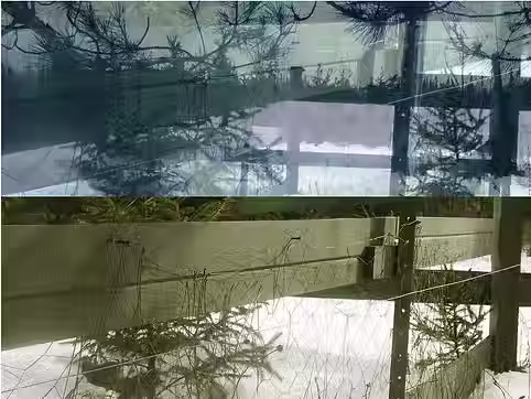
Ontario has a unique history of surveillance and colonialism, perhaps most evident in Northern Ontario. For instance, the implementation of the Robinson Huron Treaty Territory in 1850, affected northern communities such as Sudbury, Sault St. Marie, Kirkland Lake, and North Bay by extracting resources from the land (Government of Ontario, n.d). These lands and territories are important not only for resource extraction (e.g., minerals), but also for forestry, hunting, fishing, and recreation (Ministry of Mines, 2010). Ontario, as elsewhere in so-called Canada, relies on methods of “internal colonialism” to produce wealth, extract resources, and maintain the supremacy of settler colonial logics and western ways of knowing and doing (Tuck and Yang, 2012, Cahill, 2023). As defined by scholars Tuck and Yang, internal colonialism is the management of people, land, flora, and fauna to maintain wealth, power, and control by displacing Indigenous peoples and extracting their natural resources (Tuck and Yang, 2012). Internal colonialism, today, can be mapped onto the ways that settlers privatize property, police and surveil places, access and extract resources, and chart territory. For example, rural property owners in Northern Ontario use surveillance technologies (hunting/trail cameras, Closed Circuit Television [CCTV]) and deterrence mechanisms (electric fences, property markers, signs) to surveil and protect their property from interlopers (McKnight, 2020).
This form of internal colonialism is common in northern, rural, and forested areas, specifically those territories in Ontario that are traditionally marked as “the wilderness”—untouched by and lacking technological interventions (Haggerty and Trottier, 2015; Dent, 2013; Francis, 1997).
The proposed research-creation project and book manuscript will examine the increased use of surveillance technologies by landowners in rural Northern Ontario as a form of contemporary settler colonialism. Specifically, this project will highlight how surveillance and colonialism in rural areas operate in individualized and behavioural ways that are unique to rural spaces. Very little research and art examines surveillance structures in rural communities in North America, much less in rural so-called Canada and Northern Ontario. Research-creation and surveillance art will provide the lens for understanding how colonialism operates geopolitically in so-called Canada, addressing the current knowledge gap and analyzing how Northern Ontario functions as a surveillance state in its own unique and understudied ways.
This body of work is influenced by my (Stéfy's) family's settler history to these lands. Particularly Nepewassi Lake. To know more about my relationship to Nepewassi Lake and its relation to settler colonialism, resource extraction, land management, and control, see here.